07/18 - Supporting Sustainable Intensification of Farming from Space
Supporting Sustainable Intensification of Farming from Space
Farming concerns us all. It shapes our landscapes and brings food to our tables. So while at least in the developed world only a small percentage of the population works in the farming sector, the impact their work has is huge. Add to that that the global population is rising and you’ll understand what challenges the sector faces.
 Bringing food to everyone’s table is obviously the goal. But at the same time, natural resources are limited, and farming needs to stay within sustainable boundaries, so that there is no negative effect on the environment, that would ultimately decrease the resources available to us. Finding this balance – intensification of agriculture to achieve food security for the global population while at the same time staying sustainable, is the main challenge agriculture faces in this century.
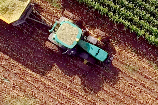
Fortunately, technical development has already made it much easier to sustainably intensify the production. First and foremost among the tools that have become widely available is satellite information for navigation (GNSS). This technology allows farmers to know where on the field they are and thus to treat every location in the field differently according to its needs.
Now the questions rising from this is – What are my crop’s needs? This is where Earth Observation comes in. Optical satellite imagery for monitoring of crops is freely and openly available thanks to e.g. the Sentinel-2 satellite from ESA’s Copernicus Program. From this data, information about crop status can be derived, from chlorophyll content to leaf area to water content, the current growth can be seen from space. Specialised service providers have developed algorithms to extract the information that’s most valuable for the management decisions, to give it on to the farmers.
One hurdle in this process so far was not only that the amount of available satellite data increased continuously, making it true big data, but also that satellite data sources as well as ancillary data sources (e.g. weather data but also information about soil conditions and terrain) were available but not available at a single source, leading to everyone having to chase down the necessary data from different websites and providers.
The Food Security Thematic Exploitation Platform aims at alleviating this problem and making it easier for everyone interested in using satellite information for agricultural purposes to calculate their service. For this, the Food Security TEP brings relevant satellite and ancillary data as well as tools and algorithms useful for processing of the data together on one platform, so that users only have to choose and combine what they need. Calculations are also done on the platform, following the big data axiom of bringing the algorithms to the data for quicker and easier handling.
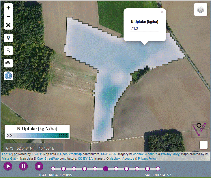 The Food Security TEP is the youngest of the seven TEPs of ESA, and has been opened to the public in March 2018. Already, two pilot applications for agriculture have shown its capacities, one of them focusing on oil rapeseed, the other on potatoes.
For the oil rapeseed, the focus of the service lay in deriving the nitrogen uptake over the winter period to give site-specific decision support for the nitrogen fertilisation in spring. This demonstration was done in Germany and is based on the TalkingFields services.
For the potatoes, Greenness and Leaf Area were calculated for continuous monitoring of the development of the crops. This service is based on WatchItGrow and was calculated in the Netherlands and Belgium.
For the second phase of the TEP development, already pilots in Africa have been chosen that will focus on micro insurance and finance, mainly in Kenya. Additionally, a pilot in the aquacultural sector is looking at the abilities of the TEP for aquacultural sites in Africa.
If you also have a great idea how to use satellite information to help making agricultural in Europe and Africa sustainably more efficient and want to try out the unique capabilities of the Food Security TEP, we have good news for you! There is a limited budget still available for additional users! Please contact Espen Volden (email) from ESA with your short proposal of what you want to do.